No failure learning in military instruction
- Military instruction probably predates school-type education by several thousand years, and it is predicated on four important principles:
- Everyone, regardless of their educational history, has to demonstrate the essential knowledge, skills and values being taught
- Learning is often a matter of personal and group survival
- The aggregated outcomes of the learning are linked to strategic responsiveness
4 The instructor breaks the lesson content into “bite-sized, sequential chunks” that must be learned before the next part of the lesson commences. The intention of the instructional design is that there can be no failure.
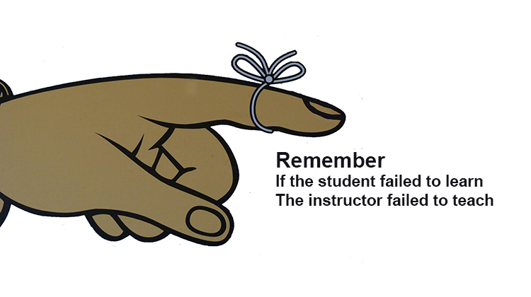
Because failure to learn may have dire consequences for military students, the American Department of the Army (1954) firmly asserts: “if a student failed to learn, the instructor failed to teach” (p. 5). Whew! That puts a different spin on our teaching doesn’t it?
The Australian Army takes teaching and the curriculum very seriously also, and every soldier attaining the rank of Corporal is required to pass courses on military instruction. A colleague noted that he had learned more about teaching and learning completing his Corporal Course than he did during teacher training at university.
The Australian Army text, “Land Warfare Procedures G-7-1-2: The Instructor’s Handbook” (2017) is a manual that clearly sets out lesson planning, lesson delivery, and lesson assessment. While teachers in schools use the acronym EDI for Explicit Direct Instruction, the Army has used this acronym for many years as Explain, Demonstrate, and Imitate, which is a variation on: I do; we do; you do.
Blair Johns, an Army veteran, explains how he would have taught longitude and latitude to troops in his infantry class, and his own Year 6 class using the Military Instruction model.
Objectives
The students will be able to:
- Explain the difference between lines of longitude and lines of latitude (TP1 [teaching point 1]).
- Find a location on a world map using provided coordinates (TP2, 3, 4).
ACARA Reference
The geographical diversity of the Asia region and the location of its major countries in relation to Australia (ACHASSK138).
Prior knowledge
- Time zones
- World parts – tropic of cancer and Capricorn, cardinal points
- Geographical knowledge
Materials
Globe for teacher
Blank maps for students
Pencil and eraser
Worksheet
Atlas for students
Video
Motivation
Watch the video “The Warship and the Lighthouse”.
Introduction
Greeting – ensure all students have the required materials.
Revision
- How many time zones are there in the world?
- Where is Zulu or GMT positioned?
- Where are the Tropics of Cancer and Capricorn?
- What it the imaginary line that divides the earth into northern and southern hemispheres called?
Approach
During this lesson you will be taught the difference between lines of longitude and latitude, why they are used and how to use longitude and latitude to identify locations on a world map.
Statement of relevance
The reason you are taught this is because longitude and latitude are the universal way in which the world accurately plots exact locations on the globe.
Statement of objective
By the end of this lesson you will be able to:
- Explain the difference between lines of longitude and lines of latitude.
- Find a location on a world map using provided coordinates.
Body
Stage 1
What are lines of longitude and latitude?
(TP1) Explain that lines of longitude and latitude are imaginary lines placed across the globe forming a grid.
(TP2) Lines of latitude run horizontally across the globe. The equator is an example of a line of latitude and is marked as the 0 point of latitude (show on globe). It divides the world into northern and southern hemispheres (students to identify on individual maps). Lines of latitude that run above the equator are referred as north latitude and south of the Equator as south latitude. The total value of the lines of latitude is 90 degrees north and 90 degrees south.
(TP3) The lines that run vertically around the globe are called lines of longitude. They are also called meridians. The Prime Meridian located at Greenwich, in England is marked as the 0 point of longitude. It divides the globe into eastern and western hemispheres. Longitude lines to the east of the Prime meridian are referred to as east longitude and lines to the west are referred to as west longitude. The total value is 180 degrees east and 180 degrees west.
Ask students to locate the equator and mark its value on their maps. Indicate with fingers a line of north latitude/south latitude.
Ask the students to locate the Prime meridian and mark its value (0) on their maps. Indicate with fingers, lines of east and west longitude.
Confirmation
Questions? (Check For Understanding = CFU)
Students to answer the following on their boards:
Define a line of longitude? Runs vertically around the globe from PM.
Is the equator an example of longitude or latitude? Latitude.
Rectify problems as required. Reteach if needed.
Points to remember:
Longitude: Imaginary lines that start from the PM and run vertically around the globe.
Latitude: Imaginary lines that start from the equator and run horizontally around the globe.
Stage 2
Explanation
(TP4) As previously stated, longitude and latitude are used to locate exact locations on the globe. We will now use this information to locate countries on a world map.
Coordinates are given in the following format:
xx degrees north/south latitude, xx degrees east/west longitude
To find a location we read the degrees for the latitude. Starting from the equator we move south or east to the latitude given. If it is between the lines we divide the lines further equally. We then read what hemisphere the longitude is in and identify the degree of longitude.
Questions? (Check For Understanding = CFU)
Demonstration
Demonstrate on the map. Talk aloud during the process, reinforcing the teaching points.
Use 30 degrees South latitude, 130 degrees East longitude (Australia)
Imitation
(IP) Guide the students through finding the location of the Maldives using 3 degrees North latitude, 73 degrees East longitude (Maldives). Ensure each student indicates with their finger each line of longitude or latitude. Provide corrections as required.
(SP) Provide students the following coordinates 33 degrees North Latitude, 67 degrees East longitude (Afghanistan). Only provide limited prompts to guide students. i.e. find the equator, identify if the latitude is north or south. And, a variety of exercises.
(IP) Provide three further opportunities for individual practice in identifying locations. Students are to record answers on worksheets.
- 60 degrees north latitude, 100 degrees east longitude – Russia
- 23 degrees north latitude, 120 degrees east longitude – Taiwan
- 4 degrees south latitude, 121 degrees east longitude – Indonesia
It is noticeable that the level of instructor direction is reduced as students correctly apply their learning.
Move around the room providing individual feedback to students.
Conclusion
Test of objectives
Objective one
Explain in your own words the difference between lines of longitude and latitude.
Objective two
Identify the following places on your world map and colouring them in the corresponding colour.
- 22 degrees north latitude, 77 degrees east longitude (Purple) – India
- 35 degrees north latitude, 105 degrees east longitude (Red) – China
- 56 degrees north latitude, 137 degrees east longitude (Yellow) – Japan
Circulate the room monitoring student performance. Identify students requiring further assistance and provide opportunities for further practice at a later stage. Collect world maps.
Summary
Give praise to class and indicate the degree to which they have worked.
The class is now able to explain the difference between longitude and latitude and how to apply this to identify countries on the globe.
Statement of relevance
The reason you have been taught this is because longitude and latitude are the universal way in which the world accurately plots exact locations on the globe. They are still commonly used in GPS systems, by pilots, cartographers, sailors and travelers to identify their exact locations.
Main points to remember
Lines of longitude are the imaginary lines that run vertically (North to South) around the globe.
Lines of latitude are the imaginary lines that run horizontally (East to West around the globe.
Longitude and latitude are used to accurately identify positions on the globe.
We read the latitude first and then the longitude.
Preview
The next lesson on this subject will be next week where you will apply your understanding of longitude and latitude further and record coordinates for a location.
Dismissal
While many teachers would claim to teach a lesson sequence in a similar manner, military instructors do not take short-cuts or vary the lesson presentation. Each military teaching lesson always takes exactly the same, semi-scripted format, and the students expect this approach. Secondly, the points that Blair makes in a lesson about supervision and formative assessment are important. During the lesson the Instructor constantly checks for understanding and this is known by the acronym CFU- check for understanding. The CFU is done in a manner that all teachers use- careful observation of the class; watch students whom you think will have problems; and, in a more formal sense, ask if anyone has a question. Thirdly, these lessons are based on what Gagne (1979, p. 7) calls the “time tested learning principles” of contiguity, repetition, and reinforcement.
with the Elements of Explicit Instruction
In the semi-scripted Military Instruction Model, as demonstrated in the Longitude and Latitude lesson shown above, it is often difficult to imagine the human movement and presence of the instructor and so readers may not see the linkages to explicit instruction. With this in mind, it was interesting to examine the Military Instructor’s lesson against the Archer and Hughes’s (2011, pp. 2-3) 16 Elements of Explicit Instruction and show the high levels of compatibility.
Sixteen elements of explicit instruction
| Archer and Hughes Explicit Instruction | Military Instruction – theory lesson |
| 1. Focus instruction one critical content. | This is set out for the instructor. |
| 2. Sequence skills logically. | This is taken from the Teaching Plan objective. |
| 3. breakdown complex skills and strategies into smaller instructional units. | This is taken from the Teaching Plan objective. |
| 4. Design organised and focused lessons | Every lesson is reversed until the content and dialogue becomes second nature. |
|
5. Begin lessons with a clear statement of the lesson's goals and your expectations. |
By the end of the lesson you will be able to ... |
| 6. Review prior skills and knowledge before beginning instruction. | The purpose of the revision or 'warm up' as it is also referred (p. 75), is taught one step at a time, following the intended sequence. |
| 7. Provide step-by-step demonstrations | The topic, having been divided into teaching points (TPs), is taught one step at a time, following the intended sequence. |
| 8. Use clear and concise language. | Communications techniques are discussed, and instructor clarity is a key consideration. It targets three particular aspects, Articulation, Use of short sentences and simple works, and Grammar. |
| 9. Provide an adequate range of examples and non-examples. | Military instruction demands the use of examples duringmodelling and practice stages of a lesson that are relevant to the students and which use equipment, skills and processes that are practicable and reflect real world illustrations. |
| 10. Provide guided and supported practice. |
Three sequential practice elements: Initial – heavy teacher guidance – demonstrations, talk about (EDI – explain, demonstrate, imitate). Secondary – limited teacher support through abbreviated talk-throughs – one-to-one guidance – CFU (Check for understanding). Final – Independent practice. |
| 11. Require frequent responses. | Questioning is use to ensure students remain on task and have understanding for the content so far. |
| 12. Monitor student performance closely. | The lesson structure and constant use of CFU clearly encourages the use of feedback to students as well as helping instructor reflection. Due to the bitesize chunks of information presented to students, the instructor can identify the areas in which further practice is required easily. |
| 13. Provide immediate and affirmative feedback immediately. | When an error is notices by the teacher, generally everyone is stopped, as it can be a good opportunity to reinforce a point. The sequence for correcting a noticed error is: explain the error, nominate the student or students making the error; correct the error, continue the practice. |
| 14. Deliver the lesson at a brisk pace. | Quick but not too quick – use common-sense to determine the speed of the lesson and the TP being delivered. |
| 15. Help students organise knowledge. | The teaching stages of the Army approach, the opening, closing and linking of each stage, shows how every TP is connected. |
| 16. Provide distributed and cumulative practice. | The use of revision prior to the teaching of a related topic allows for distributed practice. Very rarely is something is taught and then never used again by soldiers. |
Table 1. Comparison of the 16 Elements of Explicit Instruction with a Typical Military Instruction (Theory) Lesson.
Conclusions
In many cases, the formal, teaching craft lessons were lost during the 1970s when teacher training became teacher education and transferred from Teachers Colleges to universities. As a result, preservice teachers are often less prepared for classroom experiences when they first appear in schools, and they are then exposed to a hodgepodge of often conflicting, site-specific advice from classroom teachers. Explicit Direct Instruction is currently being reborn as teachers realise the moral imperative of No Failure Learning, and making certain that all students are given the basic tools of learning. We can see that Military Instruction is a useful variant of explicit instruction that gives teachers a base model on which to build their teaching and learning programs.
References
Archer, A.L., & Hughes, C.A. (2011). Explicit instruction: Effective and efficient teaching. New York: The Guilford Press.
Australian Army (2017). Land Warfare Procedures G-7-1-2: The Instructor’s Handbook. Retrieved from https://www.army.gov.au/sites/g/files/net1846/f/lwp-g_7-1-2_the_instructors_handbook_full_2.pdf
Department of the Army (1954). Techniques of military instruction. Washington, DC: Department of the Army.
Gagne, R.M., & Briggs, L.J. (1979). Principles of instructional design. New York: Holt, Rinehart and Winston.
The Battleship versus the Lighthouse. Retrieved from: https://www.youtube.com/watch?v=Knu14TlvCQE
Image adapted from Rusty Clark under flicr cc attribution license